
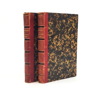
GALLIAE SEU FRANCIAE TABULA
Amsterdam: Visscher, n.d. [1680-1720]. Galliae seu Franciae Tabula. A hand-colored copper engraved map of France published by Dutch cartographer Nicolaes Visscher. The map shows France as well as parts of England, Spain, Italy, Switzerland, and Germany. The bottom left corner features a spectacular cartouche with color engravings of Neptune, Mercury, and a female representation of France. The map has not been examined out of frame but appear to be in Very Good condition with slight toning and creasing from folding. The frame measures 38"x32.5" and the map itself measures 28.5"x23". Atlas Minor Sive Geographia Compendosia. More

![1373285 NOTRE DAME DE PARIS [Three volumes]. Victor Hugo](https://secondstorybooks.cdn.bibliopolis.com/pictures/1373285.jpg?width=320&height=427&fit=bounds&auto=webp&v=1703866390)
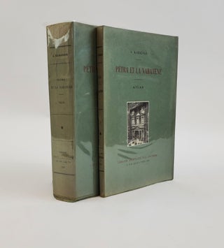
![1374516 LES VIEUX QUARTIERS DE PARIS - LA BIÈVRE [Signed by Léon Genonceaux]. Joris-Karl Huysmans](https://secondstorybooks.cdn.bibliopolis.com/pictures/1374516.jpg?width=320&height=427&fit=bounds&auto=webp&v=1701184610)

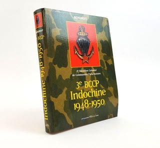
![1374140 ASSIGNMENT TO CATASTROPHE [TWO VOLUMES]. Edward L. Spears](https://secondstorybooks.cdn.bibliopolis.com/pictures/1374140.jpg?width=320&height=427&fit=bounds&auto=webp&v=1699998450)
![1373780 THE AMERICAN CAMPAIGNS OF ROCHAMBEAU'S ARMY: 1780, 1781, 1782, 1783 [TWO VOLUMES]. Howard...](https://secondstorybooks.cdn.bibliopolis.com/pictures/1373780.jpg?width=320&height=427&fit=bounds&auto=webp&v=1699466880)
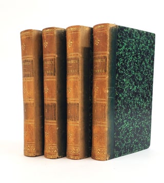
![1373164 LES ŒUVRES DE MR. GRESSET [THE WORKS OF MR. GRESSET]. Jean-Baptiste-Louis Gresset](https://secondstorybooks.cdn.bibliopolis.com/pictures/1373164.jpg?width=320&height=427&fit=bounds&auto=webp&v=1698338158)

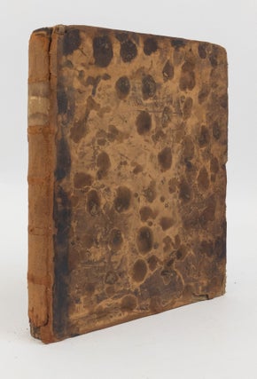
![1371601 MEMOIRS OF VIDOCQ, PRINCIPLE AGENT OF THE FRENCH POLICE [4 Volumes]. Eugene Francois Vidocq](https://secondstorybooks.cdn.bibliopolis.com/pictures/1371601.jpg?width=320&height=427&fit=bounds&auto=webp&v=1694422862)