

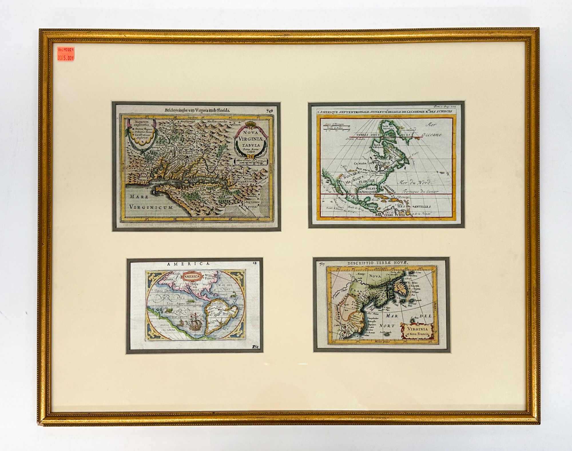
FOUR MAPS OF AMERICA, c. 1610-1707
Four small maps framed together, each illustrating some portion of North and South America. The set includes the following:
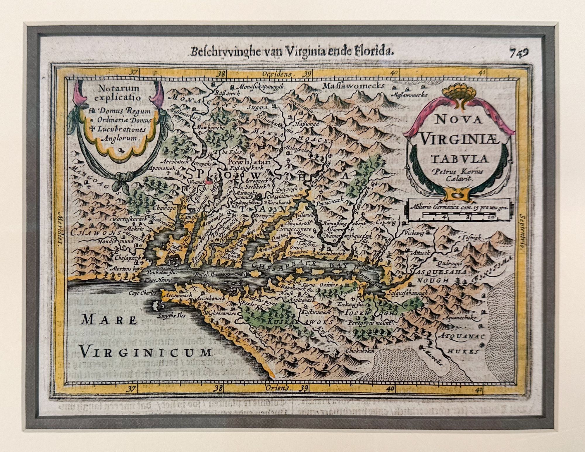
1) Nova Virginiae Tabula, by Pieter van den Keere and Jan Jansson, Amsterdam, 1631. A fine example of the 1631 German edition of Jansson’s derivative of John Smith’s highly important map of 1612, which was the only regional map of North America to appear in the Atlas Minor Gerardi Mercatoris. The map shows a fascinating early look at the Chesapeake Bay and the surrounding environs, including American Indian tribes, villages, rivers, and other early details. According to Burden, this is the first derivative of the Smith map to appear in an atlas, pre-dating the Hondius map by two years.
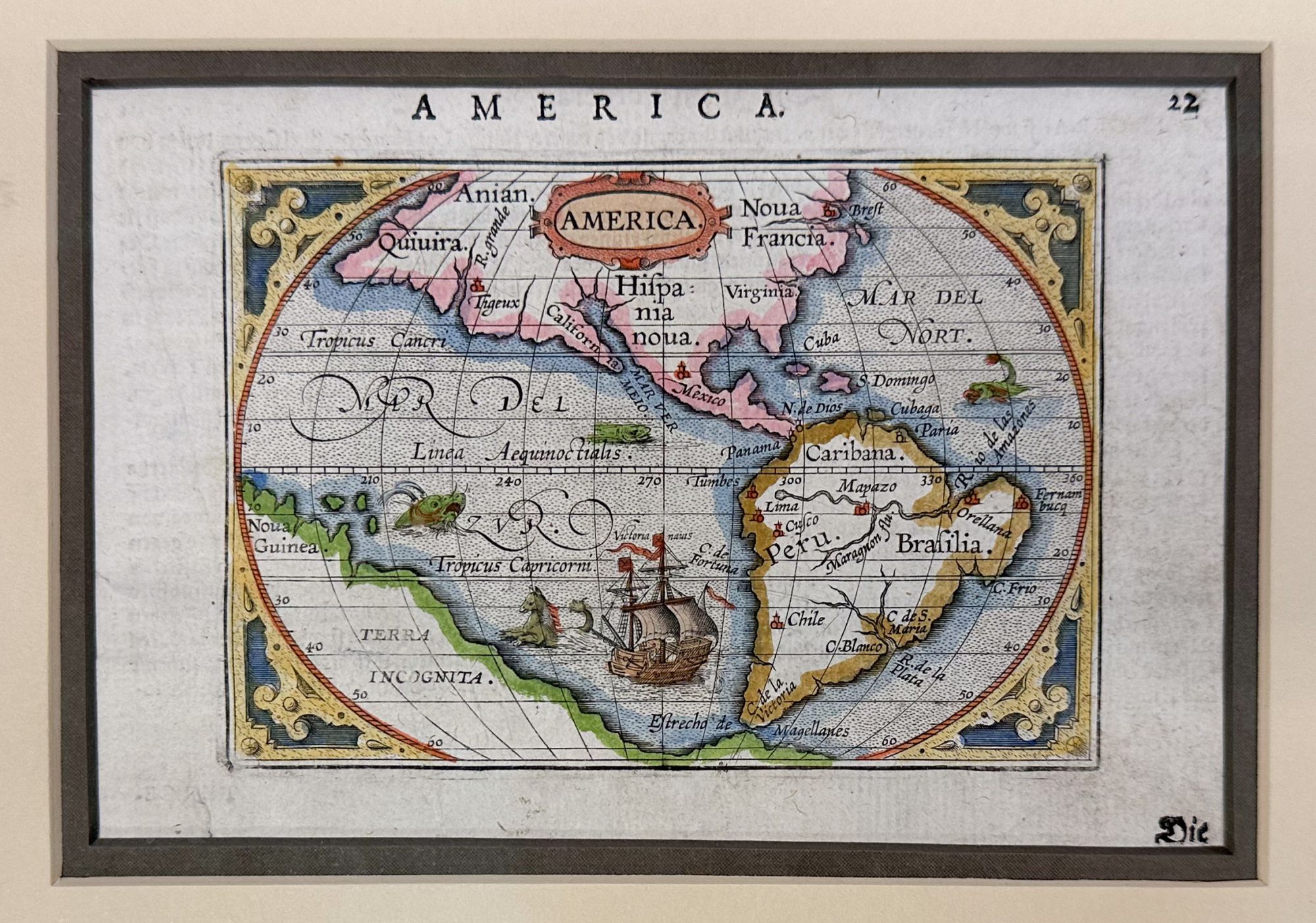
2) America, from Gerard Mercator’s Atlas Minor. This extremely popular volume was first published in 1607, but this map is c. 1610.
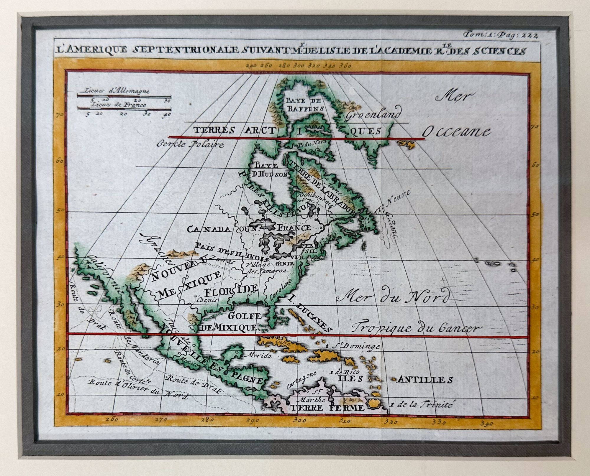
3) L’Amerique septentrionale, by Guillaume de Lisle (1675-1726). This map is taken from La science des personnes de la cour, de l'épée et de la robe, volume 1. This encyclopedia was published in Amsterdam by Francois L’Honore in 1707.
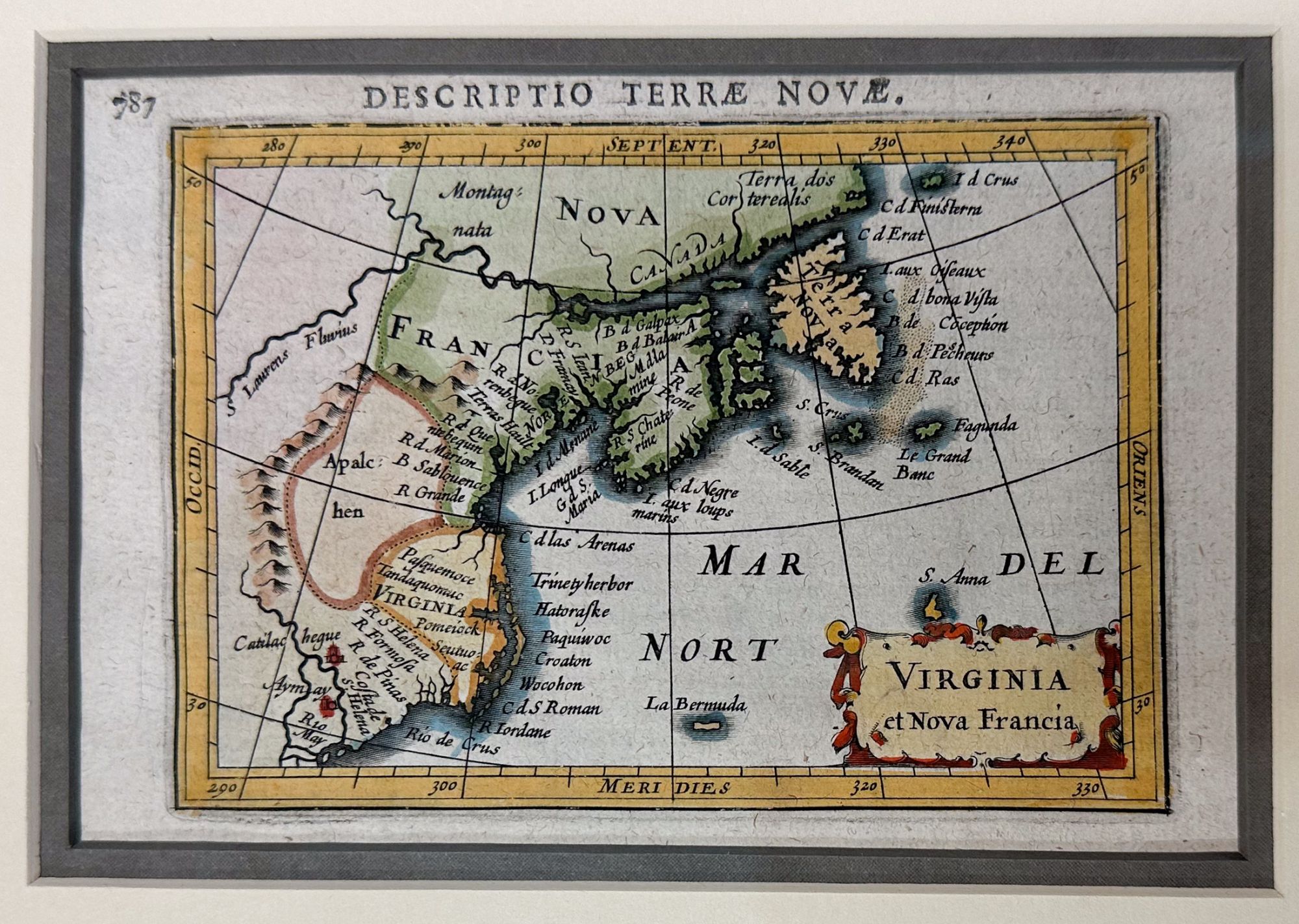
4) Descriptio Terrae Novae: Virginia et Nova Francia, 1618. This charming miniature map depicts the east coast of North America, and is based on Hondius’s world map from 1611. It does not incorporate new information from Samuel de Champlain (in Canada and along the Great Lakes) or of John Smith (in the Chesapeake Bay are and New England). The area from present-day New York to Maine is labeled Norenbega, and the area further south is labeled Virginia, with the Chesapeake Bay noticeably missing. A region just east of a large mountain range (the Appalachian mountains) is labeled Alpachen, and the St. Lawrence River features prominently at the top. Latin text on verso.
All in Very Good condition, with light to moderate even age toning. One map (3) shows a light crease, and one (2) appears to have a small tear at the bottom margin which does not impact the image. Double matted and framed; not examined out of frame.
w 23.75 in. x h 18.5 in.
1329344
Arts & Antiques
Price: $3,375