

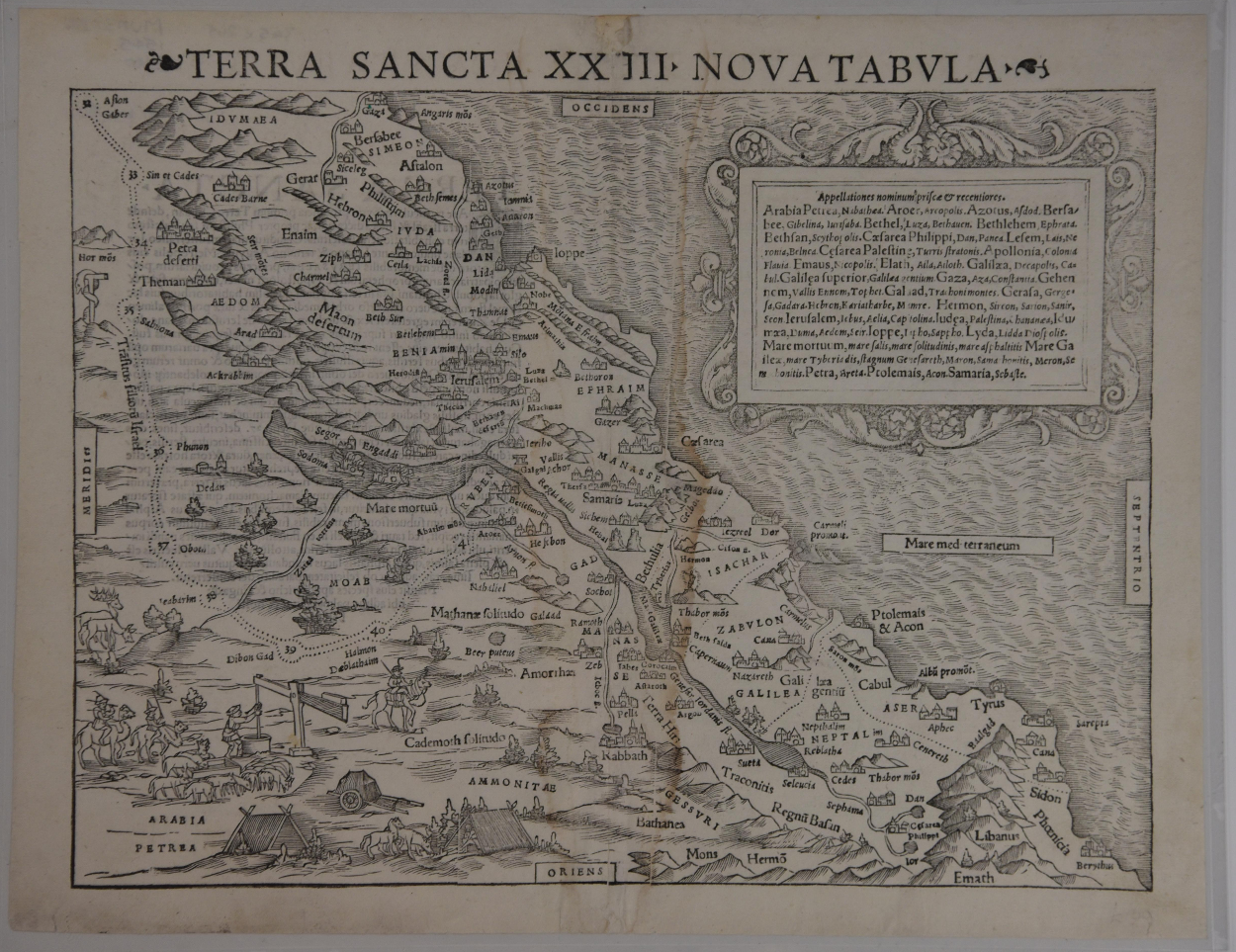
TERRA SANCTA XXIII NOVA TABULA
1540. A map printed in two stages by Henri Petri, and was published in Sebastian Munster’s 1540 edition of Geographia Universalis vetus et nova complectens… by Claudius Ptolemaeus. The names were printed from a letterpress and the map from a woodcut, and the cartouche includes a compilation of old names and their modern counterparts. The map is oriented with the West to the top. Condition: Good to Very Good. Age toning, with a central crease and evidence of water damage in the center of the map. Currently housed in a protective frame, but can be shipped rolled. Map measures 15" x 11.75", frame measures18 3/8" x 14 3/8". Shelved Rockville upstairs.
1329294
Arts & Antiques
Sold
See all items in
Arts & Antiques Store,
Maps
See all items by Henri Petri