

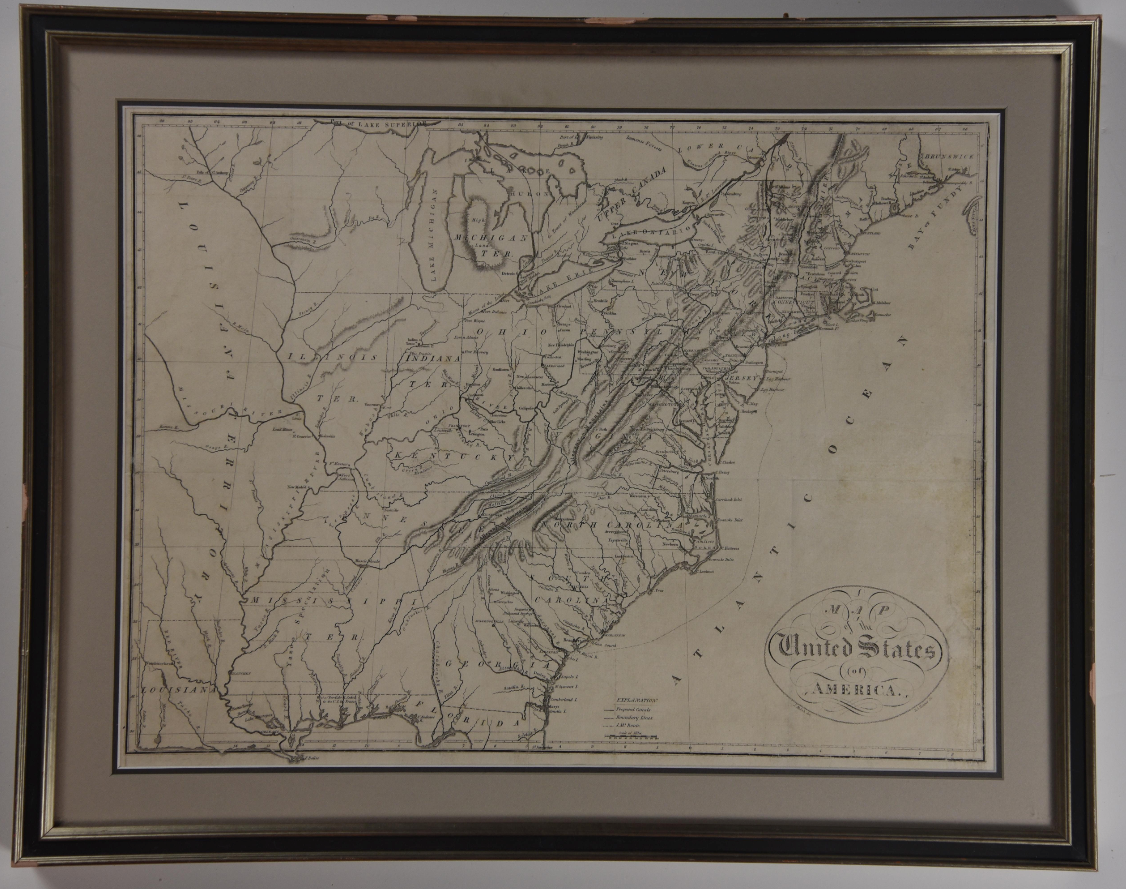
MAP OF THE UNITED STATES
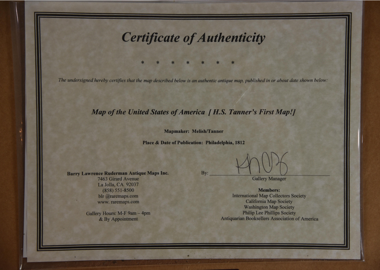
1812. A map of the United States of America by American cartographer Henry Schenck Tanner (1786-1858), published in Philadelphia in 1812. This was Tanner’s first map, and is accompanied by a Certificate of Authenticity from Barry Lawrence Ruderman Antique Maps. Condition: Very Good. Light, even age toning with faint creases and some slight darkening along the right edge. Double matted and framed; not examined out of frame. Map dimensions 17" x 13.5". Framed dimensions w 21.5 in x h 17 in.
1329343
Arts & Antiques
Sold
See all items in
Arts & Antiques Store,
Maps
See all items by H S. Tanner