
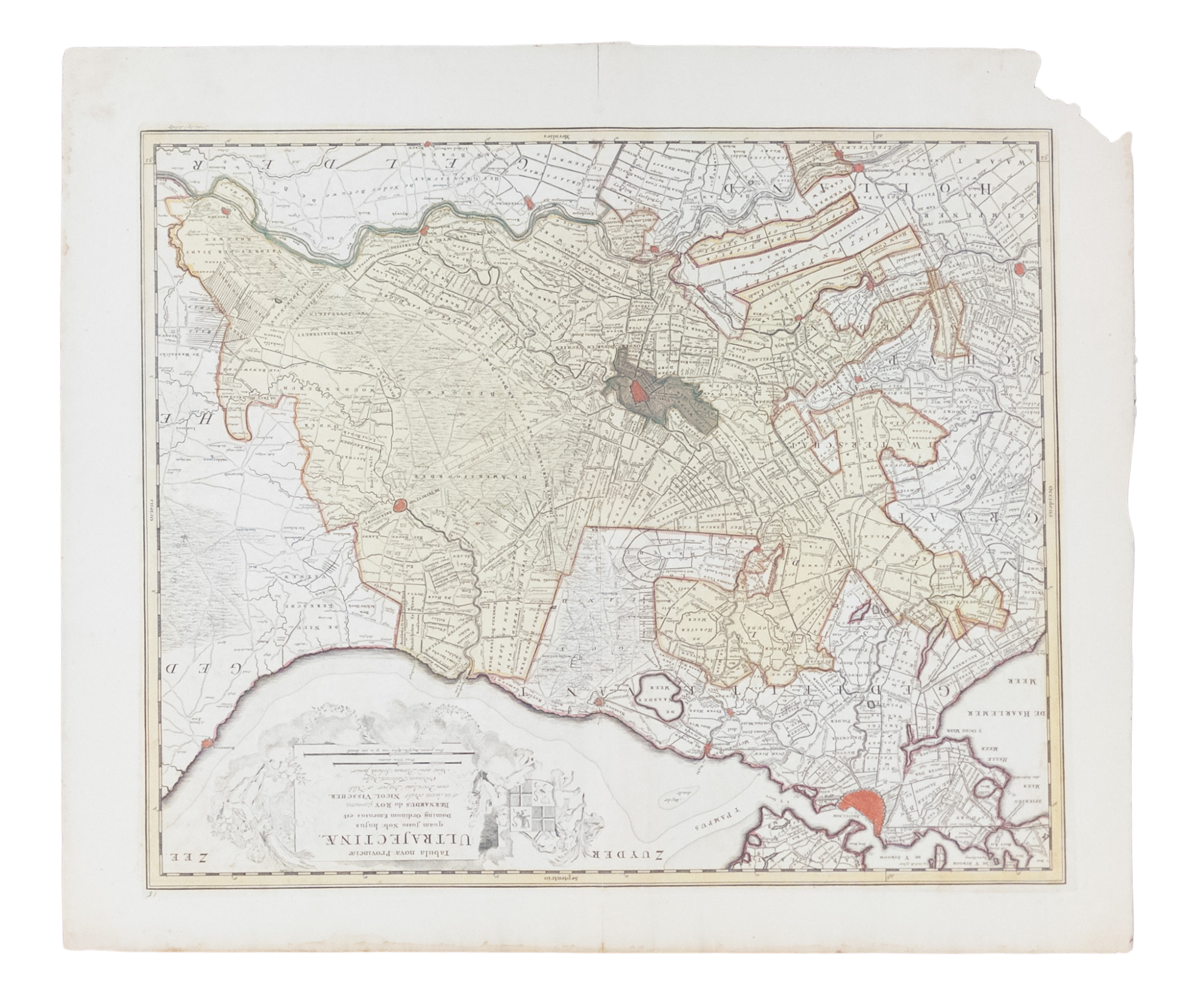
MAP OF UTRECHT AND AMSTERDAM, c. 1730
R. and J. Ottens, c. 1730. A regional map of the Netherlands showing Utrecht and Amsterdam, created by the Dutch publishers R. and J. Ottens, c. 1730. In Good condition. Some age toning, minor chips and closed tears to margins (as well as slightly longer tears at the edge of the central crease), and minor water damage to margins. w 26.5 in. x h 22.25 in.
1328600
Arts & Antiques
Price: $210
See all items by Ottens